Amsterdam Metropolitan Area
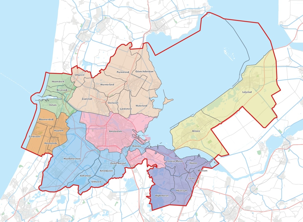
The Amsterdam Metropolitan Area is a geographical indication for the region stretching from Zandvoort to Lelystad and from Purmerend to Hilversum. The area includes 30 municipalities, gathered in seven sub-regions: Amsterdam, Amstelland-Meerlanden, Almere-Lelystad, Gooi and Vechtstreek, IJmond, Zaanstreek-Waterland and Zuid-Kennemerland.
This is the working area of the Amsterdam Economic Board. Here we work, together with decision makers, innovation managers and changemakers from businesses, academia and government to create a smart, green and healthy region.
Engine of the Dutch economy
The Amsterdam Metropolitan Area – also known as the MRA – is located within the North Holland and Flevoland provinces. The area has a population of about 2.5 million. With two airports, seaports, the financial center of the Netherlands, the Aalsmeer flower auction, world-class knowledge institutions, major media companies and clusters of creative businesses, among others, this region is a major driver of the Dutch economy. In addition, the area is characterised by attractive historic towns and great scenic variety.
Click on the map to enlarge
Metropoolregio Amsterdam – the organisation
The Metropoolregio Amsterdam is the partnership between the North Holland and Flevoland provinces, 30 municipalities and the Transport Authority Amsterdam. From a shared vision, they are working towards a strong, innovative economy, faster connections and sufficient and attractive space for living, working and recreation.